At the summit of Goleon, 3427 meters above sea level.
First part. See the next part.
On August 14, 2021, Pascal and I left Grenoble to climb, not the Goléon, but the Gioberney, but fate decided otherwise.
The day before, a violent storm had shaken this part of the Alps. A rock slide had cut off the access road to La Bérarde.
We should have taken this road, which is a dead end, to go up to the summit of Gioberney and back down in one day.
While we were on this way, a road information sign warned us of the road closure.
We inquired at the Bourg d'Oisans tourist office. The problem was explained to us there.
Well, since the mountain didn't want us at Gioberney, we would go and tickle it at the Aiguille du Goléon!

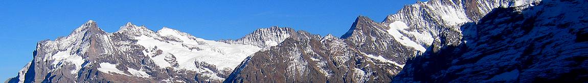
The final climb to Goléon via the ridge offers a magnificent panorama of La Meije and the neighboring peaks.
We started by going from Bourg d'Oisans to La Grave, then to Valfroide, to park in the Entraigues car park.
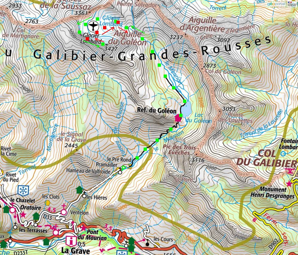
Round trip itinerary. Click to enlarge the map.
The road is narrow and stony. The tires risk puncturing. Passing another car is difficult there.
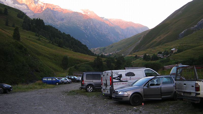
The parking lot is steep and the road to it is difficult.
After sleeping there for one night, we left the next day before seven in the morning.
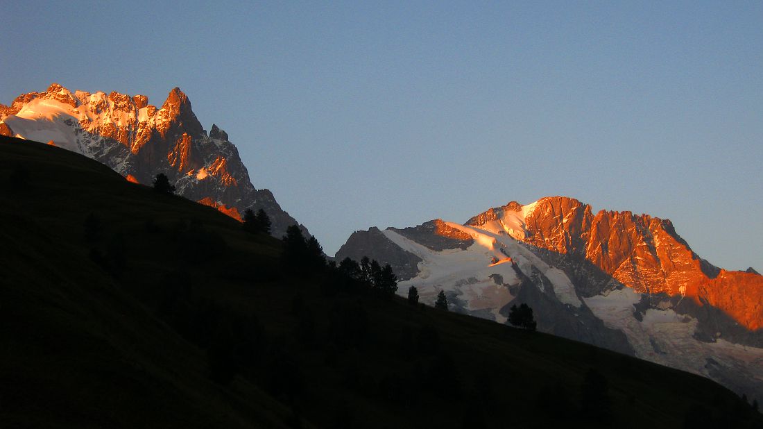
The Meije and the Rateau at dawn.
The first stage took us to the refuge and the Goélon lake, going up the course of the Maurian,
which winds nonchalantly among the stones and grass.
We arrived at the lake around a quarter past eight.
As I left them, I looked back to see the lake, the refuge and, behind them, the Meije and the Rateau.
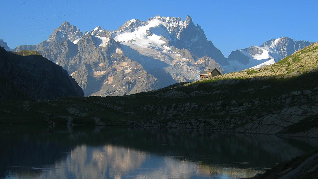
The Meije is visible at the top and a little to the left of the refuge. The Rateau is to his right.
In front of us, on our left, appeared the summit of the day and, to its right,
the needles of Saussaz and two of the needles of Arves.
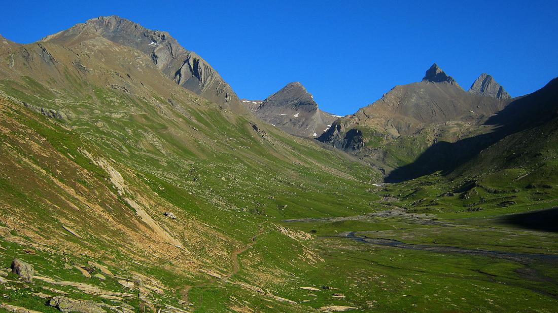
The Goleon needle is on the left, the Arves needles completely on the right.
We then passed in front of the old Carraud refuge, which does not deserve its name as a refuge since it does not offer any,
even in cases of vital need.
There is no shelter possible here; if necessary, you should go to the Goléon refuge.
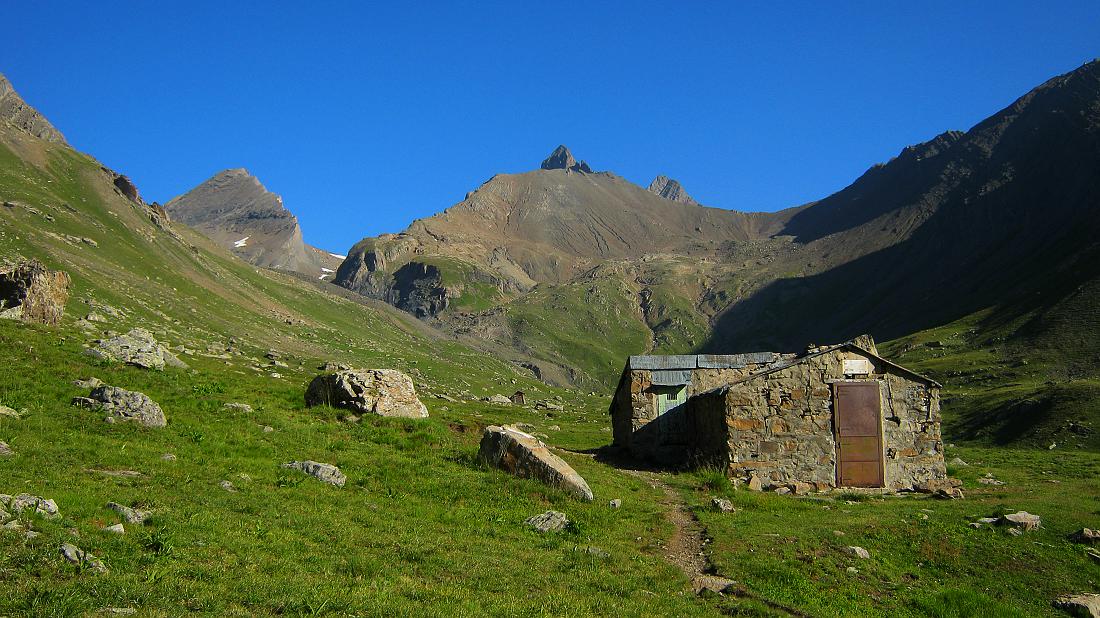
The old Carraud refuge is closed.
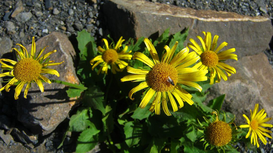
From the ground rose almost everywhere golden yellow flowers of arnica montana.
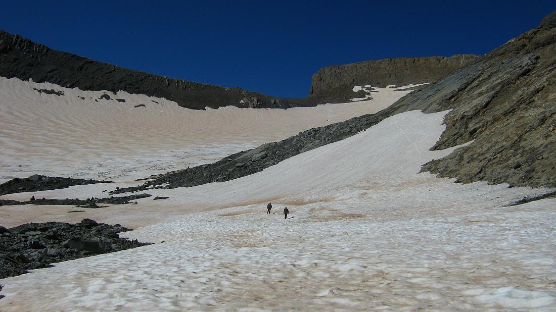
Continuing the climb, the first snowfields appeared.
Sometimes it was necessary to cross them, but the slight slope made it possible to do so without crampons.

The first snowfields are already quite large and long to cross.
But, their slope increasing as we progressed,
crossing the following snowfields required more and more effort and attention.

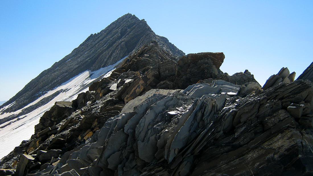
When the snowfields gave way to the Lombard Glacier, the route leading to the summit turned gradually to the left.
Guessing it is easy, because you have to go from the glacier to the ridge, then follow it.
Other groups were already coming down, all we had to do was go towards them.
We then left the glacier for the last part, the long easy ridge which leads to the Goléon peak.
And, suddenly, on the right, a magnificent panorama of the Meije and the Rateau was revealed,
while, behind us, the Mont Blanc range appeared in the distance.

As we approached the summit, we had a better view of the entire Lombard Glacier.

Finally, we arrived at the summit.